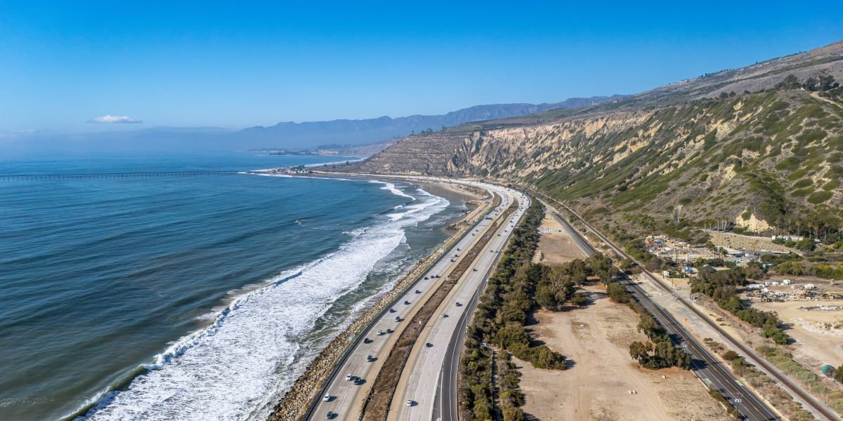

Governor Gavin Newsom signed an executive order on October 27 creating a Highway 1 Task Force to prepare the coastal route and the communities that depend on it for El Niño storms that forecasters say could reach historic strength. A second order expands flood preparedness across California before winter weather arrives.
Key Takeaways
- Newsom signed the Highway 1 order at Crystal Cove State Park in Newport Beach, where coastal erosion and a major bluff crack show the risks already facing the coastline.
- The Highway 1 Task Force is led by the California State Transportation Agency and the California Natural Resources Agency.
- Emergency project spending on the Big Sur stretch of Highway 1 totaled about $312 million from 2020 through 2026.
- A second executive order builds on the September 21 El Niño emergency proclamation with new tools to reduce flood risk statewide.
- Caltrans is staging storm equipment at more than 120 maintenance yards, with about 1,300 pieces of winter operations equipment ready to deploy.
- Federal forecasters give the current El Niño a 75% chance of reaching historic strength, according to the governor’s office.
Newsom Signs Highway 1 Order At Crystal Cove State Park
Governor Gavin Newsom chose a location that made the problem easy to see. He signed the Highway 1 executive order at Crystal Cove State Park in Newport Beach, where coastal erosion and a major bluff crack elsewhere in the park show how exposed parts of California’s coastline already are. El Niño-driven ocean conditions can make those risks worse when they combine with high tides and powerful surf.
“It keeps our coastal economy moving,” Newsom said of Highway 1, adding that the road gets people to work, children to school, goods to local businesses and first responders where they are needed. He said the state knows what repeated closures cost coastal communities and is putting agencies to work to reduce the danger before storms hit.
What The Highway 1 Task Force Will Do
The order creates a Highway 1 Task Force led by the California State Transportation Agency and the California Natural Resources Agency. Its job covers both this storm season and the years beyond it.
The task force will identify vulnerable stretches of the highway, recommend priority actions and funding needs, and find ways to get preventive work done faster. The order also directs Caltrans to prioritize landslide prevention where practicable and asks California State Parks to assess how closures and repairs could affect parks and public access.
“Highway 1 is the gateway to many state parks and beaches along California’s coast,” said State Parks Director Armando Quintero, who described cross-agency coordination as critical for visitor safety, public access and emergency response.
Repeated Closures Carry A Steep Cost For Coastal Communities
The financial case for acting early is clear in the state’s own numbers. Emergency project expenditures on the Big Sur Highway 1 corridor totaled approximately $312 million from 2020 through 2026, according to the governor’s office.
Those figures capture only the repair bill. When Highway 1 closes, coastal residents lose their routes to work, school and medical care. Small businesses that rely on visitors lose customers, and first responders face longer trips to reach people in danger. For many coastal towns, the highway also serves as the main evacuation route during emergencies.
The new order is designed to shift the state’s approach from repairing damage after storms to reducing risk before they arrive, with the goal of fewer closures and less disruption for the communities that bear those costs.
A Second Order Expands Flood Preparedness Statewide
Newsom also signed a second executive order building on the El Niño state of emergency he proclaimed on September 21. The new order gives state agencies additional tools to reduce flood risks and protect communities and critical infrastructure from other anticipated El Niño impacts.
“Keeping communities safe means taking action before a storm arrives,” said Cal OES Director Caroline Thomas Jacobs, whose office is coordinating state agencies, preparing resources and supporting local partners under the emergency proclamation.
El Niño Conditions Raise The Stakes This Winter
El Niño refers to the periodic warming of sea surface temperatures in the eastern Pacific Ocean, a shift that often brings more frequent and intense storms to California. Those storms can cause flooding, landslides, debris flows and coastal erosion.
This year’s event is drawing particular concern. The governor’s office has said federal forecasters give it a greater than 90% chance of being very strong this fall and winter and a 75% chance it could reach historic strength. California has already seen coastal flooding attributed to El Niño this year.
Natural Resources Secretary Wade Crowfoot said a marine heat wave off California’s coast has already raised sea levels by a full foot, adding to the pressure on low-lying roads and bluffs.
Caltrans Crews Prepare Roads Before Storms Arrive
Caltrans is preparing across the state by inspecting known trouble spots, training crews and positioning equipment so teams can respond quickly as storms approach. Crews are clearing catch basins, ditches and culverts so runoff moves away from roadways, and checking pumps along the way.
Sandbags and sediment-control materials are being staged near vulnerable locations, including wildfire burn scars, where heavy rain can trigger debris flows after this year’s wildfire season. Storm-response equipment and supplies are ready at more than 120 maintenance yards statewide, with about 1,300 pieces of winter operations equipment available.
Crews in all 12 Caltrans districts are prepared to move to continuous storm coverage and 12-hour emergency shifts when needed.
How Drivers Can Stay Safe On Coastal Roads
The California Highway Patrol is urging drivers to prepare for fast-changing conditions, including flooding, landslides, debris flows and road closures. Drivers can check Caltrans QuickMap for closures, traffic conditions and chain controls before heading out.
CHP advises reducing speed on wet roads, leaving extra distance between vehicles and avoiding cruise control in the rain. Drivers should check tires and windshield wipers and turn on headlights whenever wipers are in continuous use. Above all, drivers should never go through floodwater, which can hide a damaged or washed-out roadway.
FAQs
What Does Newsom’s Highway 1 Executive Order Do?
The order creates a Highway 1 Task Force to prepare the coastal route for El Niño storms and longer-term climate threats. It directs agencies to prioritize preventive work, including landslide prevention, before storms hit.
Who Leads The Highway 1 Task Force?
The California State Transportation Agency and the California Natural Resources Agency lead the task force. Caltrans and California State Parks also have specific assignments under the order.
How Much Has Highway 1 Storm Damage Cost California?
Emergency project expenditures on the Big Sur Highway 1 corridor totaled about $312 million from 2020 through 2026, according to the governor’s office.
How Strong Is The 2026 El Niño Expected To Be?
The governor’s office says federal forecasters give it a greater than 90% chance of being very strong this fall and winter. They put the chance of it reaching historic strength at 75%.
How Can Drivers Check Highway 1 Road Conditions?
Drivers can use Caltrans QuickMap to check road closures, traffic conditions and chain controls. Local forecasts and emergency alerts also help drivers plan around storms.